| |
|
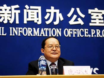
Lu Xinshe, director-general of State Bureau of Surveying and Mapping, answers questions at a press conference sponsored by the State Council Information Office in Beijing, on Feb. 24, 2006. [Photo: China.org.cn]
|
At the press conference sponsored by the State Council Information Office on February 24, 2006, Lu Xinshe, director general of the State Bureau of Surveying and Mapping, briefed the press on achievements of surveying and mapping in the 10th Five-Year Plan period and prospects in the 11th Five-Year Guidelines period. He also answered questions from the press.
Full text:
Speech by Lu Xinshe, Director General of the State Bureau of Surveying and Mapping
February 24, 2006
Achievements of surveying and mapping in the 10th Five-Year Plan period
Surveying and mapping is a preliminary and foundational endeavor for national economic and social development. It serves various sectors in economic development, national defense and peopleĪ»s daily life by providing location-based thematic and comprehensive information. With the economic and social development and advancement of science and technology, more and more importance has been given to surveying and mapping work by governments at all levels and all walks of life. Under the leadership of the Central Party Committee and the State Council, we made notable progress and gained marked achievements in surveying and mapping field. Here I will introduce to you on the following five aspects:
First, we revised the Surveying and Mapping Law of the PeopleĪ»s Republic of China. To meet the demands of the development of surveying and mapping undertaking, the Surveying and Mapping Law was amended and promulgated in August, 2002, which thoroughly defines the administrative system for surveying and mapping work, basic surveying and mapping, market access, results management and legal responsibilities. In accordance with the Surveying and Mapping Law, we drafted the Regulations on the Administration of Surveying and Mapping Results, the Regulations on Basic Surveying and Mapping, and submitted them to the State Council for examination. We also promulgated the Provisions on Administration of Verification and Publication of Important Geographical Information and Data. And 23 local regulations of surveying and mapping were also promulgated. The legislation system has guaranteed the healthy development of surveying and mapping undertaking of China.
Second, we carried out operations jointly with relevant governmental departments to rectify the maps market. Over 5,000 cases were handled. More than two million illegal map products were confiscated. We also strengthened the examination for maps to be published. The order of the market was improved remarkably.
Third, we established the digital surveying and mapping technology system. On the basis of the achievements attained in the 8th Five-Year Plan and the 9th Five-Year Plan periods, we made continuous efforts for independent innovation, and pressed ahead with applications of advanced technology. We organized and launched the national fundamental surveying and mapping infrastructure project and accomplished the transformation from the conventional technology to the digital technology. The production capacity of surveying and mapping departments increased dramatically.
Fourth, we provided effective surveying and mapping services. We developed more than 200 decision-making systems with basic geographic information for scientific decisions of the government agencies. 200-plus national or local key projects, such as Three Gorges Project, South-to-north Water Diversion, and West-East Natural Gas Transmission, benefited from our timely surveying and mapping services. Various kinds of maps were provided to the general public. The development of car navigation industry was encouraged. Compared to the 9th Five-Year Plan period, the provision of topographic maps, geodetic survey results, and aerial photo products increased by 6.4 percent, 91.2 percent, and 281 percent respectively, and the provision of digital map data increased 12 times in the 10th Five-Year Plan period. Surveying and mapping work has played a more and more important part in public management, economic and social development, and serving the public.
Fifth, we pushed forward the establishment of the Geospatial Framework of Digital China. We established the National GPS Geodetic Control Network 2000 and the National Basic Gravimetric Network 2000. The national aerial photography program was conducted and aerial photos covering about 3.3 million square kilometers were obtained. In 2005, we successfully measured Mt. Qomolangma and announced the elevation of its summit rock above the sea level. We promoted the construction of provincial fundamental geographic information systems at the scale of 1:10,000 and fundamental geographic information systems of some large and medium sized cities. Especially, the 1:50,000 Database for the National Fundamental Geographic Information System was completed. Later I will talk more about it at this conference.
The 1:50,000 database for the national fundamental geographic information system
The 1:50,000 database for the national fundamental geographic information system (1:50,000 database for short) was just verified for acceptance on February 18. The construction of the database was the largest project of the national basic surveying and mapping during the 10th Five-Year Plan period, which lasted for 8 years with a total investment of over 700 million yuan. The project was organized by the State Bureau of Surveying and Mapping (SBSM) and was completed with the participation of about 10,000 people from over one hundred organizations of the central and local governments and the army.
The 1:50,000 database is a basic geographic information database that covers whole China with the characteristics of largest scale, largest volume of data, richest contents, and highest precision. The database covers all the land areas of China containing 7 datasets of elevation, imagery, terrain, geographic names, land cover, raster maps and metadata. The total volume of the data is 5.3 TB, equal to the storage of over 8,000 compact discs. In the 1:50,000 database, the terrain dataset contains such physical and human features like hydrology, residential areas, transportation and boundary, including the data of state and provincial roads of over 300,000 kilometers and county and township roads of more than 1.3 million kilometers. The land cover dataset contains features of farmland, forest land, grassland, water areas, residential areas, industrial land and wild land. The geographic names dataset contains 5.29 million names including all place names at or above village level and names of physical features. The imagery dataset contains images of 1 meter resolution that cover all the large and medium sized cities and developed areas of China, which means you can locate your apartment building in the image dataset.
According to the analysis of the demands for the surveying and mapping results, the 1:50,000 topographic map is one of the mostly used maps in economic development. The 1:50,000 database will be used more broadly in the future. First, it will provide fundamental support for economic and social development. The new socialist rural development, the development of west China, utilization of energy and resources, environmental protection, and urbanization progress all require 1:50,000 basic geographic data. Second, the database will play a role in supporting scientific decision-making of the governments, providing basic geographic data for land planning, regional planning, resource survey and evaluation, disaster prevention and alleviation, and the construction of public emergency response system. Currently, the 1:50,000 database has been used for the Spatial Decision-Supporting System for E-government of the State Council jointly organized and developed by the General Office of the State Council and SBSM. Third, the database will serve as a platform for the construction of E-government and E-commerce in the progress of IT industry. The SBSM and the National Bureau of Statistics have agreed to jointly build a platform for national economic and social statistics data. Forth, the database will play an impetus role in the development of geographic information industry, providing basic data for car navigation, mobile positioning, intelligent transportation, and modern logistics. Fifth, the database will play a role in raising peopleĪ»s living quality, providing more and more geographic information for their daily life, traveling and exploration.
So far, the data from the 1:50,000 database have been provided for application to over a thousand organizations in the sectors of land, urban planning, water resources, agriculture, forestry, environment protection, transportation, communications, electric power, national defense, research and education, which has resulted in good social effects and economic benefits. Next, we will make efforts in providing data to promote the wide applications of the 1:50,000 database. The data catalogue can be obtained at the website of the National Geomatics Center of China, or at the website of SBSM.
Prospects for the Surveying and Mapping Work in the Eleventh Five-Year Plan Period
Presently, the new situation of building a well-off society in an all-round way raises higher requirements for the surveying and mapping work. In the 11th Five-Year Guidelines period, we will stick to the scientific concept of development for overall governance of the surveying and mapping work, to unified supervision as a principal administrative function, to scientific and technological innovation as a constant driving force for growth, to basic surveying and mapping as the groundwork of the whole undertaking, and to providing support and service for economic and social development as the essential objective of the surveying and mapping work. We will earnestly carry forward the administration according to law, strengthen unified supervision, speed up the development of information-based surveying and mapping system, establish the public service system with the Geospatial Framework of Digital China as a principal component, strive to promote the development of the geographic information industry, and provide effective support for economic growth, national defense and social progress.
In the 11th Five-Year Guidelines period, five goals are set for the surveying and mapping work.
The first goal is to enhance the capacity of administration according to law. The surveying and mapping legislation system will be perfected to adapt to the socialist market economy, the unified supervision of surveying and mapping remarkably strengthened, and a uniform, open, competitive and orderly market of surveying and mapping basically formed.
The second goal is to enrich the fundamental geographic information resources. Modernized national surveying and mapping reference system will be established. Basic aerial photography will cover areas of over 6 million km2. National land area will also be covered by remotely sensed satellite imagery of multiple resolutions. New generation fundamental geographic information at 1:50,000 will cover over 95 percent of national land area. Fundamental geographic information at 1:10,000 will cover necessary areas. Fundamental geographic information at 1:2,000 or larger scales will cover built-up areas of cities and towns above the county level.
The third goal is to strengthen scientific and technological innovation capabilities. Geographic information capturing, processing, managing and application technologies will be improved comprehensively. Information-based surveying and mapping technology system will be basically set up. Surveying and mapping software and hardware with independent intellectual property rights will notably increase in variety and quantity. Geographic information standards system will be perfected. International cooperation and exchanges in surveying and mapping will further progress.
The fourth goal is to bring surveying and mapping support and services to a new level. Policy and mechanism for surveying and mapping results application will be further improved. New generation national topographic maps at basic scales and public edition topographic maps will be worked out, a considerable variety of geographic information platforms set up, digital product series formed, public products system further enhanced, and web-based fundamental geographic information services basically realized, so as to provide more effective support for economic and social development.
The fifth goal is to ensure sound and fast growth of the geographic information industry. The industry development policy will be basically perfected, geographic information resources utilized to a notably greater extent, abundant and various products and services provided for economic and social progress and for the public life, and a number of backbone enterprises with independent innovation capabilities established. Geographic information industry will see the scale merits and become a new economic growth source among modern service industries.
To further enhance the surveying and mapping support and service capabilities in the 11th Five-Year Guidelines period, major efforts will be devoted to six priority areas, with the support of other relevant departments.
Ż┐ Conducting the 1:50,000 western region topographic mapping project to meet the demand of economic and social development in the west part of China.
Ż┐ Launching the high resolution stereo mapping satellite to improve the capability of quick capture of geographic information.
Ż┐ Carrying out the offshore islands and reefs mapping project to maintain national marine rights and interests and promote national marine economic progress.
Ż┐ Developing the modern national reference system to provide dynamic, real-time and all-weather high precision positioning services.
Ż┐ Constructing modernized facilities for national surveying and mapping archives and services to improve information-based surveying and mapping results management and web-based services.
Ż┐ Implementing the 1:50,000 database updating project to make the data as current as possible and meet the demand of economic and social development. |
|